This page was last updated on: June 6, 2017
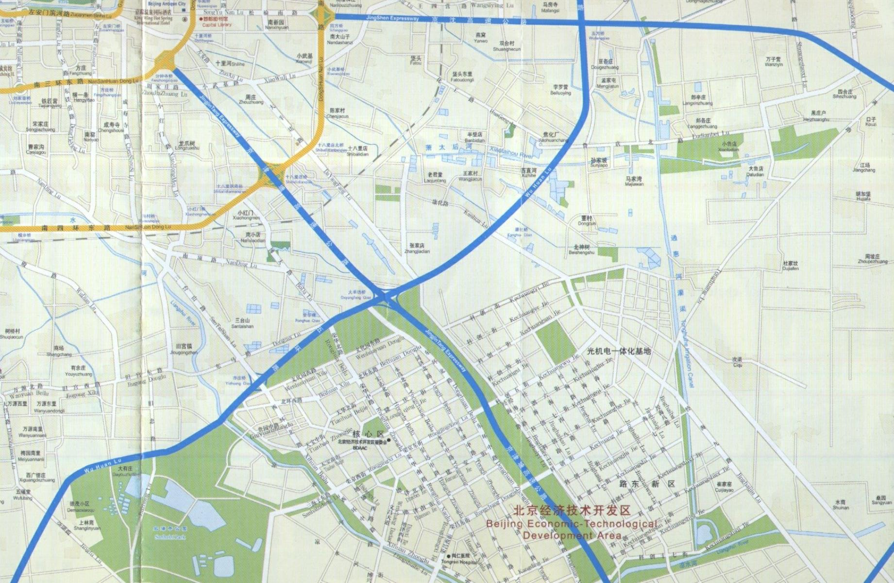
The Map Image extends between the South-Eastern area's of the Chongwen District of Beijing's Central Old City of which Longtan Park can just be seen in the north-west (left upper corner) of this map image, and the south and south east of Yi Zhuang High Technology Economic Development Zone. A large part of the northern border of the development zone is made up by Wu Huan Road, which serves at the 5th Ring Road of Beijing. JinjinTang Expressway cuts in a south-eastern direction  through the center of the zone.
Map of Daxian District - Yi Zhuang High Technology Economic Development Zone
All Maps Menu by The Beijing Report
Go to www.drben.net webring
To Main Menu of All Websites at DrBen.Net
ChinaReport.com at
Capital Library
Panjiayuan
Market
This page was last updated on: June 6, 2017
My Great Web page
Beijing Landmarks
Beijing Introduction
Beijing Online Sources
Beijing
Beijing Home
Beijing Hotels
Beijing Maps - Index
Beijing Public Transport
City Province Transport
Beijing by District(s)
Chongwen
ChaoYang
Dongcheng
Fengtai
Haidian
XiCheng
Xuanwu
6 Outer Suburbs
TiananMen Square
Alphabetical Order
By Function(s)
Forbidden City
Hebei Province
Hebei Province Home
China Offline Sources
AsiaReport.com Home
China Report Home
China Online Sources
China Online Store
China Maps
China
China Photo Galleries
China Report Club
4 Rural Districts
Shijingshan
Maps of Chaoyang
Maps of Chongwen
Maps of Dongcheng
Maps of Fengtai
Maps of Xicheng
Maps of Xuanwu
Maps of Haidian
Maps of Shijingshan
Beijing Great Wall Maps
Beijing North China Maps
Historic Maps of Beijing